Covsoc Supporter Alan Denyer gives us his thoughts on the Ring Road…..
Modern marvel, or outdated relic from bygone age of car-centric planning?
Here’s what Wikipedia says about Birmingham’s (now long-gone) “Inner Ring Road” – it makes interesting reading;
The A4400 (or Inner Ring Road or Queensway) was a main road in Birmingham that previously formed a ring around the then much smaller city centre. Junctions on the road were largely grade-separated, with pedestrians kept physically separate from vehicular traffic and most junctions allowing vehicles staying on the road to pass over or under those using the junction. It is now widely regarded as one of the classic urban planning blunders of the 20th century.
Although seen as a revolutionary improvement when its first section opened in 1960, the “concrete collar”, as it became known, was later viewed by council planners as an impenetrable barrier for the expansion of Birmingham’s city centre. In particular, it became unpopular with pedestrians, who were required to use subways at the roundabouts – which, understandably, created resentment, not least because subways were widely perceived as crime-ridden and unsafe. According to 2011’s Birmingham Big City Plan, the Inner Ring Road has restricted open spaces, growth and economic activity. It has also made the city centre more crowded and harder to navigate.
Since 1988, Birmingham City Council has sought to recreate links between the city centre and the neighbouring areas, enlarging the city centre and improving the pedestrian environment across the city, with a particular emphasis on shifting vehicular movements out to the The Ring Road.[5] Pedestrian crossings are replacing underpasses.
What are the implications of any of this for Coventry and its own inner ring road? First, it’s true there has been some (comparatively modest) change. The Council’s recent re-design of Junction 6 – finally putting pedestrians first – is excellent, with broad new “greened” access into Warwick Row from Friargate and the train station.
But is this anywhere near enough? The recent push by central government for a city-centre congestion charge to combat pollution is, we think, a major wake-up call for Coventry. And, disappointingly, minor tinkering (while they wait for the mass adoption of electric cars) seems to be our Council’s only strategy, one that wishes away rather than rises to the challenge.
Is there, a much bigger – blue sky – opportunity here?
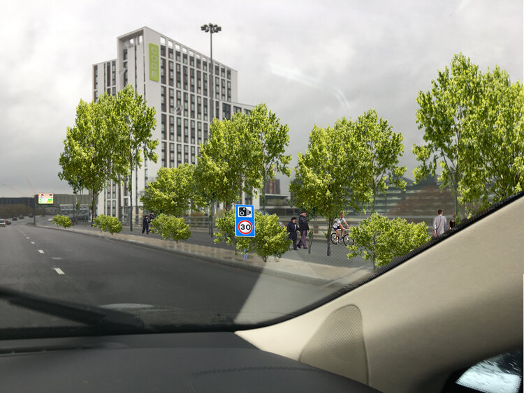
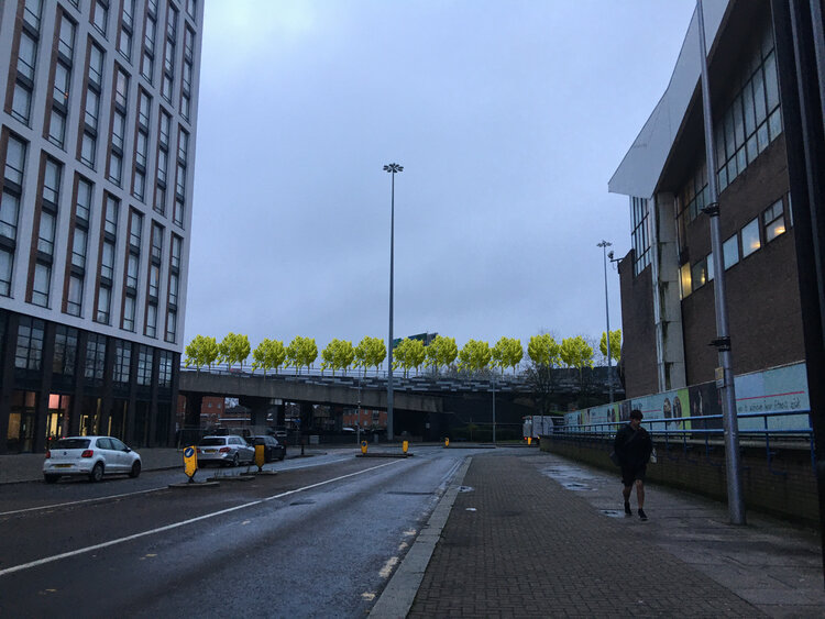
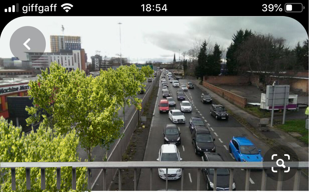
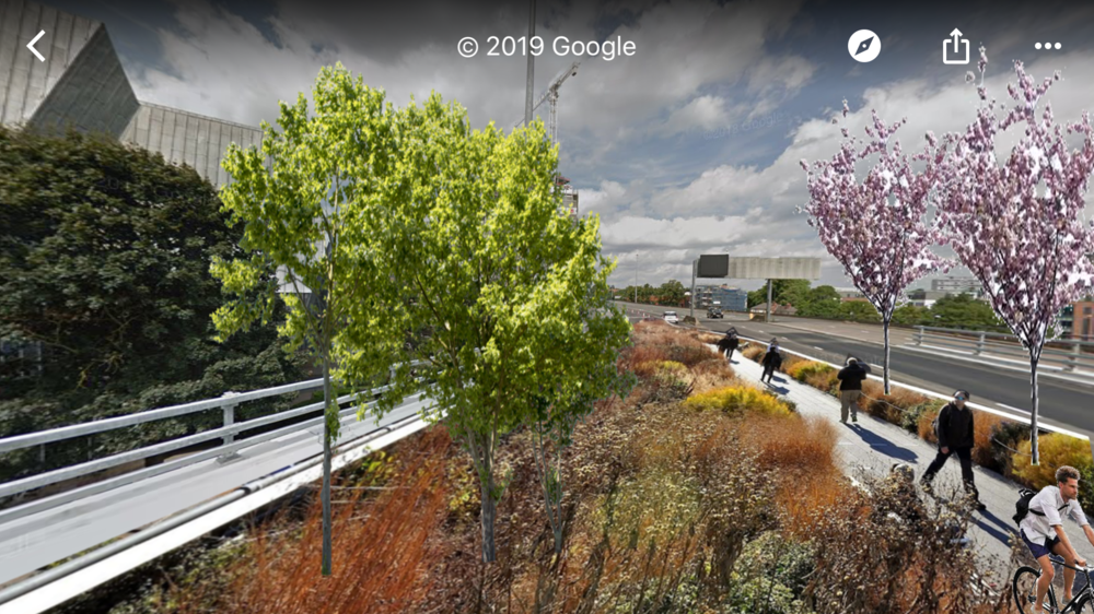
Imagine, for instance, the ring road as an elevated, circular, green space. A 2.25-mile-long public park, with integrated cycle paths linking adjoining residential districts (our visuals show how such a park might look, utilising the entire anti-clockwise carriageway circuit). A “green-lung” that re-balances pedestrian and car. A bold, innovative place-making initiative that places Coventry firmly on the world stage. Such a move would demonstrate that the city is prepared to respond to the climate emergency with verve and confidence, as well as with an eye to its own heritage and history.
Fanciful? I don’t think so. A new plan with this idea at its heart would remove central government’s threat of charging motorists for access (bad for the city’s growth, with little tangible upside).
In addition, it could also dramatically re-frame visitor perceptions. This has been the case with the “High Line” in New York City. Since 2009, this 1.45-mile stretch of elevated subway has been in use as a community park, becoming an unexpected yet phenomenal success. Since opening, it has fired the public imagination, attracted 12.5 million visitors and helped spark the regeneration of an entire (previously run-down) neighbourhood.
Consider again Coventry’s ring road circuit and you’ll see we already have many of the ingredients to make this work here without unduly restricting traffic flows.

The sketch shows how the main clockwise carriageway circuit could operate independently as a one-way system, with the network of junctions and interconnected slipways allowing access into the city for parking plus car & bus transits to and from adjoining neighbourhoods (incidentally, the ringroad is set up like this – ie. traffic allowed clockwise only – one Sunday each year for the ‘sky ride’ family cycle event, and works fine).
Crucially though, it all needs joined-up thinking. There must be new linking with an “outer ring road” infrastructure plan (as Birmingham has done), with the key objective of removing through-traffic from the centre. Bear in mind that approximately 90% of cars using our ring road today are transiting, rather than visiting the centre for retail, leisure or jobs.
On the face of it, Coventry’s ring road is the counterpart to Birmingham’s reviled Inner Ring Road – a historic planning blunder. It was certainly hugely destructive – requiring the clearance of almost 700 buildings, including many historic treasures and a huge swathe of real estate with great potential.
But here’s the rub – Coventry’s ring road is also one of the city’s architectural glories. Far from “just a road”, the soaring, swooping ring road is actually a proudly distinctive part of our city. Iconic, trailblazing, emblematic – it’s steeped in social history, a symbol of Coventry’s pioneering “motor city” story. It’s arguably as much a part of Coventry’s DNA as Godiva or the Blitz.
So maybe, unlike Birmingham, we should keep our ring road. But just plant trees and flowers on it.
Like New York did with their High Line.
And let people walk, cycle … and enjoy elevated greenery, birds, insects, unusual views, art and stories.
Welcome, then, to Coventry’s Ring Road. Re-imagined. A circular, walkable, elevated greenspace.
The defining image perhaps of a new green, zero-carbon city centre, and …
… the birth of Coventry’s own High Line park.


